Tag: Dublin
-

The Etymology and Age of Dublin’s Street Names Mapped
Click here to view the map November 2023 – I’ve updated my map of Dublin’s street names, making a few corrections and adding a good few more dates. The dates can be difficult, because I’ve been limiting myself almost entirely to historic maps of Dublin. However, getting into the OSI’s 25 inch (1907-ish) and 6…
-

Making “The Destruction of Dublin” a little more navigable
tl/dr: click here to go straight to the map A few months ago, I started to read Frank McDonald’s “The Destruction of Dublin”, and got completely and utterly lost. I could tell the book was interesting and one I wanted to read, but I just couldn’t follow in my head all of the streets and…
-

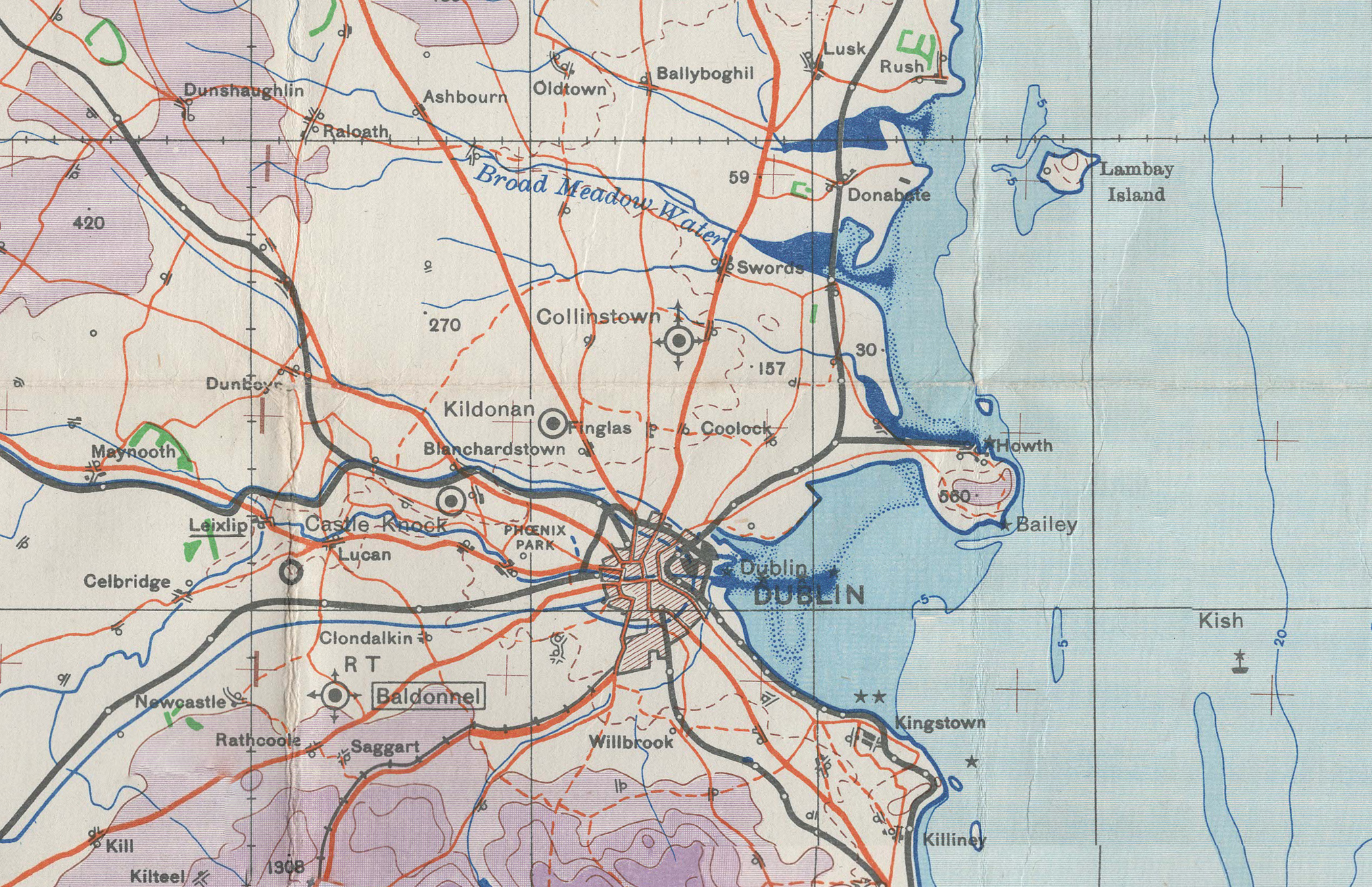
British War Office chart of Dublin, Ireland (printed 1941)
This is a large chart produced by the British War Office and Ordnance Survey in 1940, printed 1941, covering the area around Dublin. It shows a huge amount of information, including topography, rivers, towns, roads, railways, and airfields.
-

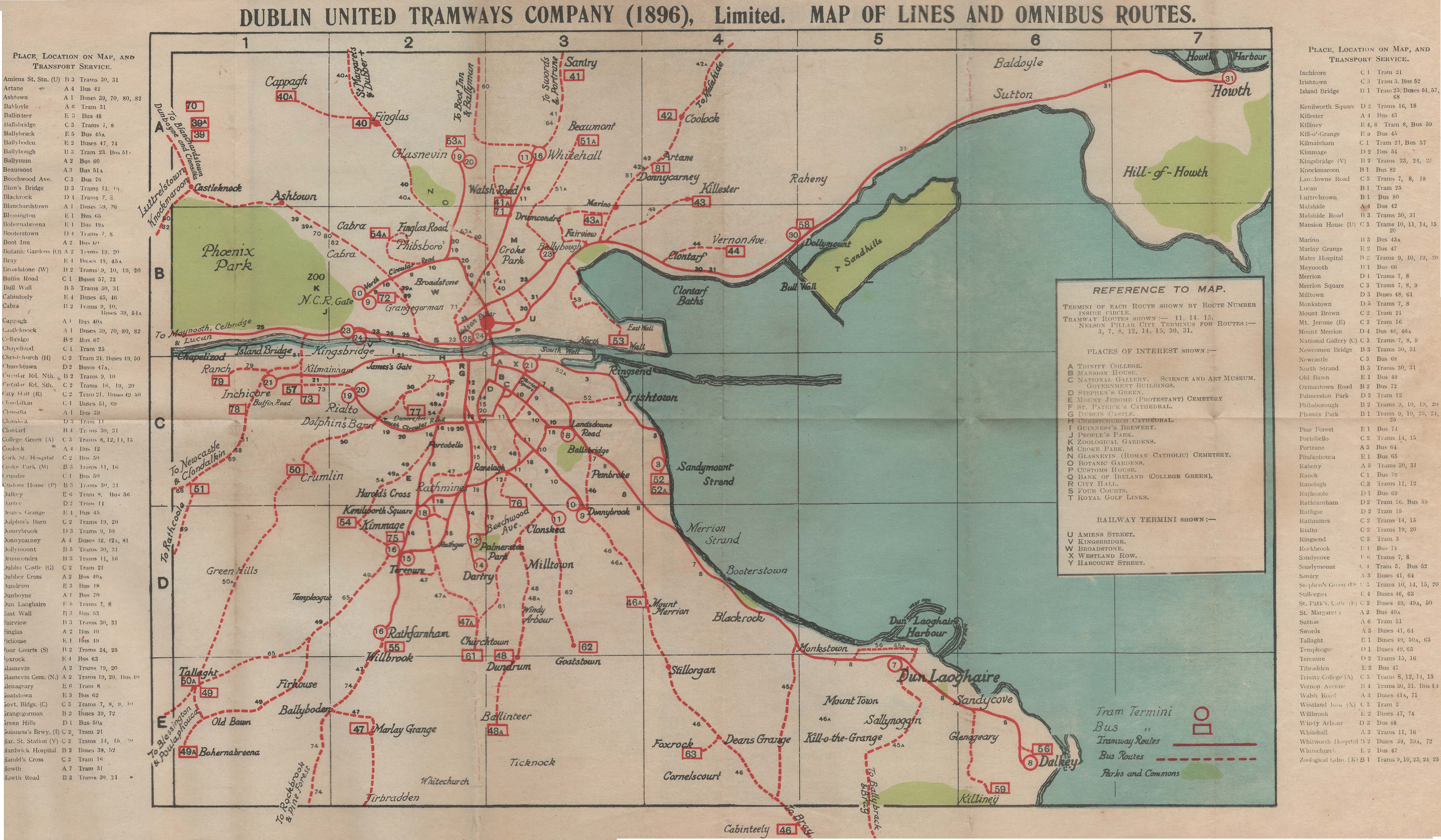
Dublin United Tramways Company (1896) tram and bus routes
Dublin United Tramways Company (1896) map showing tram lines and omnibus routes. It was looking like this map got lost in the post on its way to me, so I decided to recreate it using the images I had of it. After a couple of weeks working on the drawn version, the original appeared at…