Tag: illustration
-
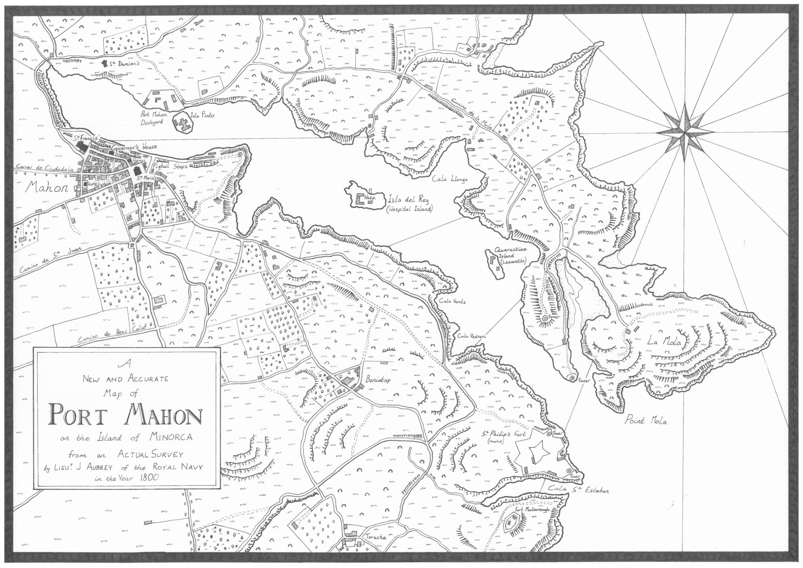
Which it’s a map of Aubrey-Maturin’s Port Mahon
Note: I’ve since posted this map on Instagram, including a few more close-ups of the details. Check it out here, here, and here if you’re interested! Master and Commander, the first of Patrick O’Brian’s epic series of naval fiction featuring Jack Aubrey, a Royal Navy Officer, and Stephen Maturin, his friend, a naval surgeon and…
-
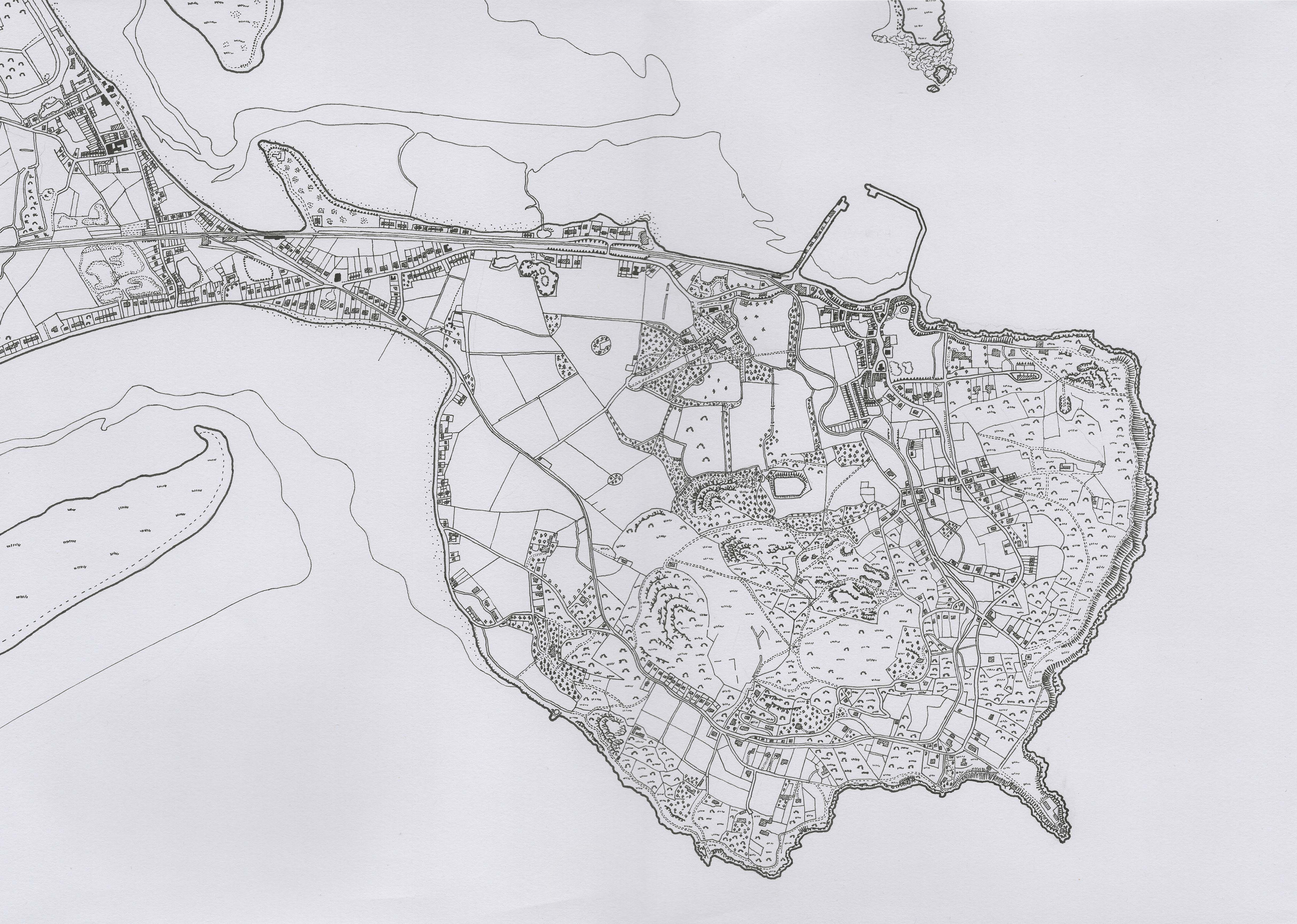
Howth Head – Six Inch Casini style drawn map
Drawn on an A3 sheet with Pitt Artist Pens from Faber-Castell, I drew this map during one of the first Covid lockdowns. It is a recreation of the Ordnance Survey’s 6 inch map showing Howth Head.
-
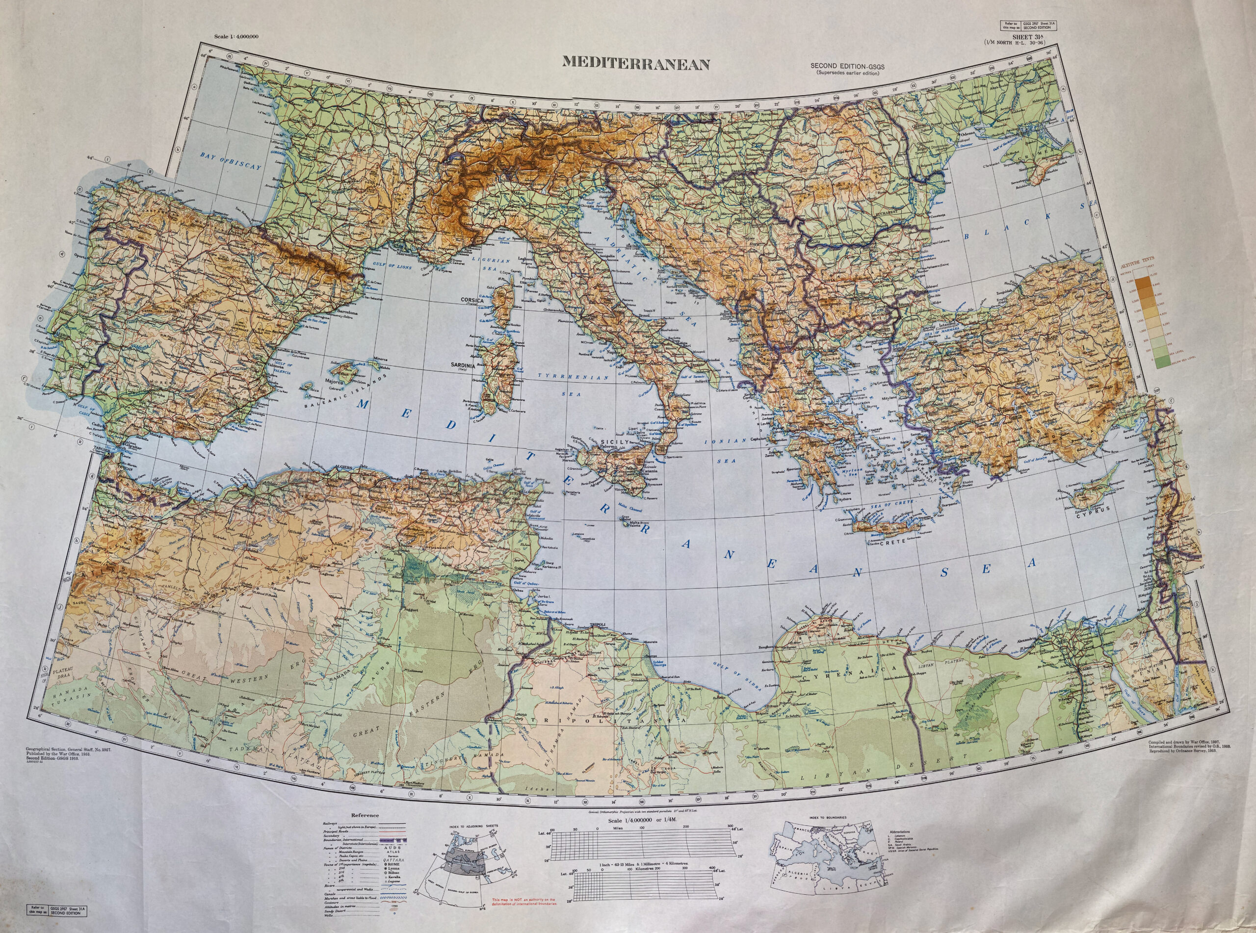
War Office map of the Mediterranean, 1937 (printed 1953)
British War Office map of the Mediterranean, dating from 1937, with revisions to international boundaries by the Ordnance Survey in the 1950s. I really like the colour schemes on this map, as well as the sections which go beyond the border (not sure if there’s a cartographical term for when this happens, but I like…